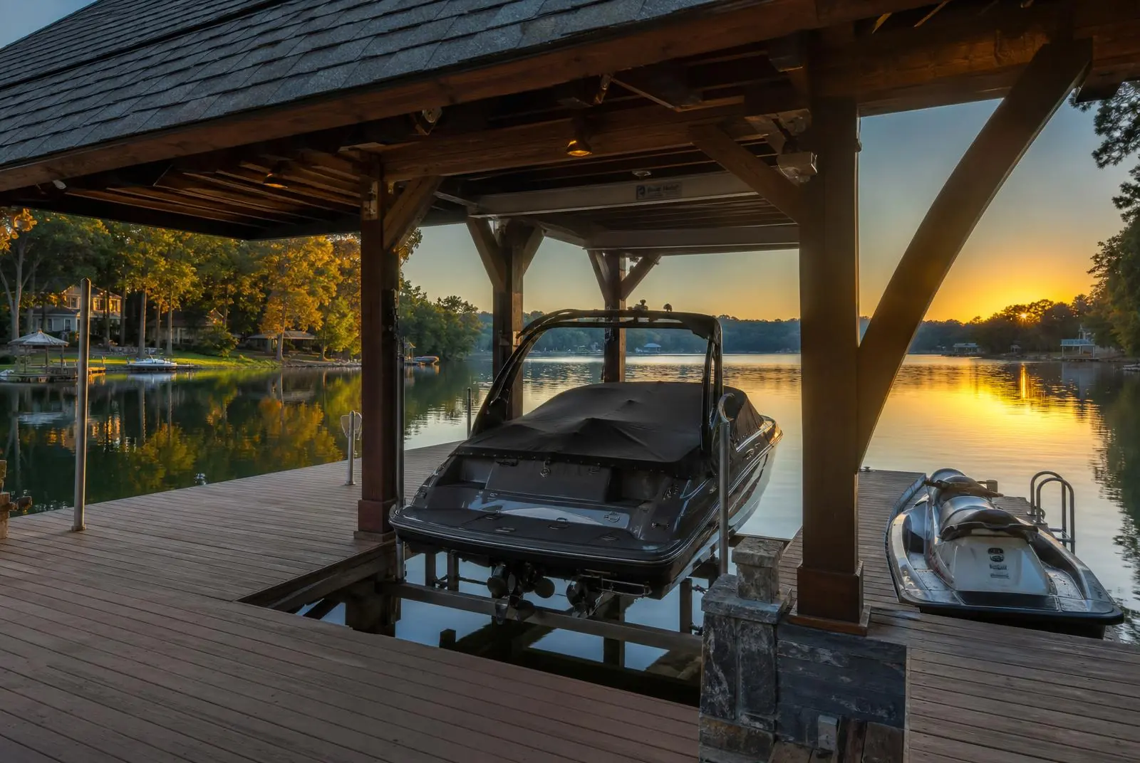
Lake Wylie Waterfront Living
Every decision in The Palisades — from the road plan to the dock design — is grounded in Lake Wylie. This is the shoreline the community was drawn around.
Lake Wylie is a 12,455-acre Duke Energy reservoir of the Catawba River, completed in 1904 and named for a Charlotte physician who championed the region's early hydroelectric development. It runs 29 miles from the dam at Fort Mill upstream toward Mountain Island Lake, with 325 miles of shoreline threaded through cove after cove.
Of that shoreline, The Palisades occupies one of the most complex and sheltered peninsulas — a series of protected finger coves and one wide open-water reach that anchors the community's most prominent estate homes. The peninsula's orientation means that almost every waterfront lot enjoys either dramatic western light over open water or the still, protected quiet of a private cove. Buyers weighing the rest of the reservoir — the Belmont, Steele Creek, and Tega Cay shores beyond this peninsula — will find that wider context covered at Living Lake Wylie.
Lake Wylie is not a view. It is a working surface — commuted across by kayak in the morning, by pontoon in the afternoon.
Coves
A geography of quiet.
Local residents distinguish the community's coves the way city residents distinguish neighborhoods. Big Allison Creek anchors the northern edge of the peninsula, offering the broadest open-water views and, correspondingly, the most active boat traffic. Beaverdam Creek defines the southern shore — narrow, protected, and lined with mature waterfront estates that have evolved with the community.
Between them, a network of smaller inlets and coves shelters most of the community's private docks. Idle-speed enforcement along the shoreline keeps these coves genuinely quiet, and the morning acoustic environment on a calm Saturday is one of paddles, birds, and little else.
Docks & Access
Ownership, permitting, and design.
Private docks on Lake Wylie are permitted through Duke Energy's Lake Management Plan, with community-level review by The Palisades design authority. Dock design guidelines favor modest profiles, natural materials, and coordinated freeboard heights; the community avoids the visual chaos common to less regulated lakes.
Peters Custom Homes handles dock design and permitting concurrently with new home construction, and Peters & Associates guides buyers through dock viability during lot due diligence. For residents without direct waterfront, the community marina and shared community docks provide slip rentals and daytime access without shoreline maintenance responsibility.
Life on the Water
A calendar of coves.
The lake operates on a longer calendar than most Northern reservoirs. First paddles by mid-March; wakesurfing from May through September; the golden autumn from mid-October through early November, when hardwood color reflects across still water and the tourist traffic has receded. Winter is a private season of long shoreline walks and quiet mornings watching mist lift.
Common Questions
What waterfront buyers ask.
How much of The Palisades sits on Lake Wylie?+
The community's peninsula includes more than 6 miles of Lake Wylie shoreline, split between private waterfront lots, community-held shoreline, and preserved nature buffer. Roughly one in six homes in The Palisades is direct waterfront.
Can I have a private dock?+
Yes, for direct waterfront lots — subject to Duke Energy shoreline management permitting and the community's dock design guidelines. Typical permitting runs 90 to 120 days. Non-waterfront residents have access to community docks and the marina.
Is the lake safe for swimming?+
Lake Wylie is a Class WS-V reservoir with regularly monitored water quality suitable for full-body contact recreation. Most residents swim from private docks, community docks, or the country club pool complex.
What can I do on the water?+
Everything typical of a full-service reservoir: powerboating, wakesurfing, sailing (small-fleet), kayaking, standup paddleboarding, and fishing (largemouth, spotted bass, striper, crappie). Idle-speed zones near the shoreline keep the coves calm.
Editorial Standards
Sources & References
Facts on this page are drawn from the primary sources below. Details change; verify anything material against the original source before relying on it.
- 01Duke EnergyLake Wylie — reservoir information and current lake levels ↗
Operator of the Wylie Hydro Station; publishes full-pond elevation and current lake levels.
- 02Duke EnergyCatawba–Wateree Shoreline Management Program ↗
Governs dock, pier, dredging, and vegetation permitting on Lake Wylie shoreline.
- 03Catawba-Wateree Water Management GroupCatawba-Wateree River Basin water management ↗
Basin-wide flow and drought-response framework affecting reservoir elevations.
- 04N.C. Wildlife Resources CommissionBoating regulations and vessel registration ↗
No-wake rules, registration, and safety requirements for Lake Wylie's North Carolina waters.
- 05U.S. Geological SurveyNational Water Information System — Catawba River basin gauges ↗
Real-time stream and reservoir gauge data for the Catawba system.
Waterfront Advisory
Considering a waterfront home?
Peters & Associates guides waterfront buyers through cove selection, dock viability, and community due diligence.
Further Reading
Continue Exploring
Estates
Waterfront neighborhoods on Lake Wylie
Peninsulas, coves, and private docks across the shoreline.
ReadReference
Full pond, drawdown, deepwater — defined
The shoreline vocabulary that determines what you can actually build and moor.
ReadIn-Depth Guide
Docks and shoreline permits on Lake Wylie
Who regulates the shoreline, what full pond means, and what to verify before buying waterfront.
Read